'/%3E%3C/svg%3E) EN
 DE
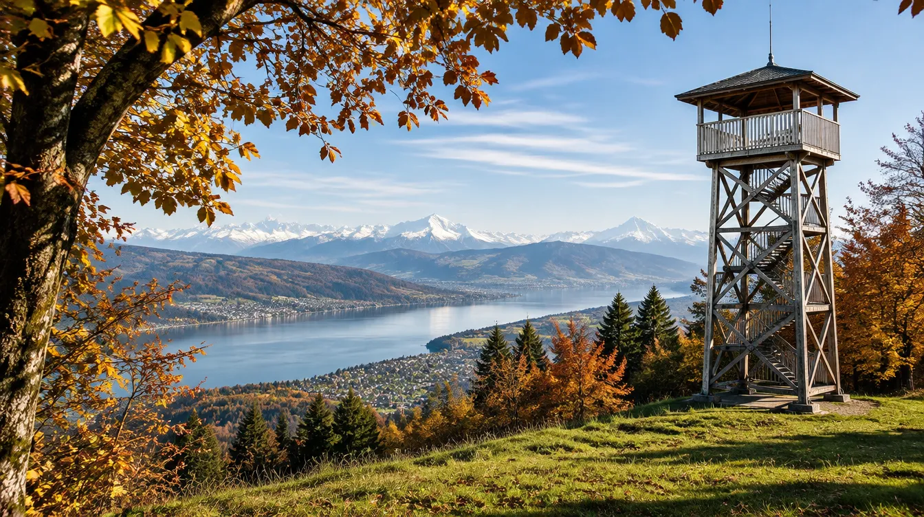
The Pfannenstiel is the wooded ridge above the “Gold Coast” of Lake Zürich, between the lake and the Greifensee, and its classic hike from Forch to Meilen is the easiest proper walk you can start from the city centre. The Forchbahn takes 21 minutes from Stadelhofen to Forch; from there you walk about three hours over the 853-metre top, past a 19th-century steel lookout tower and a country restaurant, down a gorge with a waterfall and a castle ruin to the lake. There is no lift, no ticket and no season: the trail is open all year, and in November it is often above the fog. We checked trains, fares, restaurant hours and the works at Forch station on the official sites on 16 November 2026. For more walks, see our winter hikes near Zürich and the day trips from Zürich hub.
📍 Pfannenstiel ridge, between Forch, Egg and Meilen, about 30 minutes from Zürich HB · 🥾 Forch–Meilen 10.6 km, about 3 hours, easy · 🎟️ free; ZVV 24-hour ticket for 5 zones CHF 22.80 (CHF 11.40 with Half Fare) · 🚋 S18 Forchbahn from Stadelhofen, back with the S7 from Meilen · official route
| Getting there | S3 or S12 from Zürich HB to Stadelhofen (3 minutes), then the S18 Forchbahn to Forch: departures at :14, :29, :44 and :59, 21 minutes. From HB to Forch about 31 minutes. Faster to the top: S7 to Meilen (16 minutes), then bus 922 at :01 to “Meilen, Vorderer Pfannenstiel” (12 minutes) |
|---|---|
| Getting back | From Meilen: S7 at :03 and :33 to Zürich HB in 14 minutes, or the S6 in 23 minutes. Bus 922 leaves Vorderer Pfannenstiel at :14 for Meilen station |
| Fare | Zürich HB–Forch and Meilen–Zürich HB are 4 zones each (zone 110 counts double, plus 140 and 130 or 141): single CHF 9.40. For the round trip buy a 24-hour ticket for zones 110, 130, 140 and 141 (priced as 5 zones): CHF 22.80, CHF 11.40 with Half Fare. ZVV prices rise by about 2% on 13 December 2026 |
| Timetable change | From 13 December 2026 the Forchbahn and the S7 keep the same pattern: on a test Saturday in January 2027 the S7 at :11 and S18 reach Forch in 29 minutes. Check sbb.ch on the day |
| Works now | Forch station is being rebuilt until about mid-December 2026; follow the signs to the platforms. On 21–22 November 2026 buses replace the S18 between Forch and Esslingen (Stadelhofen–Forch runs normally) |
| Restaurant on top | Restaurant Hochwacht, open 7 days: Monday to Saturday 10:00–22:00, Sundays and holidays 09:00–20:00, hot food from 11:30 |
| Best time | All year. October and November for colours and the sea of fog; May and June for meadows; after snow for cross-country skiing on the Guldenen |
| Time needed | Half a day: 3 hours of walking plus a long lunch. The short version from Vorderer Pfannenstiel takes 1 h 35 |
Four Pfannenstiel routes compared
The ridge is crossed by a dense net of yellow-signed trails, so you can make the walk as short or as long as you like. These are the four we recommend, all on public transport at both ends:
| Route | Distance and time |
|---|---|
| Forch – Pfannenstiel – Hochwacht – Toggwil – Meilen (the classic) | 10.6 km, about 3 hours, roughly 230 m up and 500 m down. The route of Zürich Tourism and SwitzerlandMobil |
| Vorderer Pfannenstiel – Toggwil – Meilen (the short one) | 6 km, about 1 h 35, 110 m up and 410 m down. Bus 922 does the climb for you; good with children |
| Vorderer Pfannenstiel – Hochwacht – Okenshöhe loop | About an hour there and back from the bus stop, with the tower and the restaurant. Ideal on a short winter afternoon |
| Forch – Küsnachter Tobel – Küsnacht | About 2 hours, mostly downhill (70 m up, 330 m down), through a gorge with a “dragon cave” and the Wulp castle ruin. A different side of the ridge; it does not go over the top |
If you only remember one tip: walk from Forch towards Meilen, not the other way. You start high, the climbing is gentle and spread out, and you finish by the lake with a train every 15 minutes.
1. Forch station and the Forchdenkmal — the start
📍 Kaltensteinstrasse 32, 8127 Forch (Forchbahn station, 679 m) · 🕐 always open; ZVV ticket office in the station · 🎟️ free · 🚋 S18 from Zürich Stadelhofen, 21 minutes · Forchbahn · 🗺️ Show on map
The Forchbahn, locally called “Frieda”, leaves Stadelhofen as a tram on the street and turns into a suburban train after Rehalp. Forch sits on a pass at 679 metres, and from the station you already see across the Greifensee to the Zürich Oberland. Until about mid-December 2026 the station is a building site while the signal box is replaced, so some paths are closed; signs show the way.
Ten minutes up from the car park stands the Forchdenkmal, an 18-metre copper flame on a stone pyramid, built in 1922 for the Zürich soldiers who died on duty in the First World War, most of them from the Spanish flu. Locals call it “de gfroore Furz” (the frozen fart). It is a short detour before the forest and a good first viewpoint. Background is on Wikipedia (German).
2. Guldenen — open fields and the cross-country trail
📍 Vorder-Guldenen, 8132 Egg (on the ridge, about 40 minutes from Forch) · 🕐 always open · 🎟️ free, including the ski trail · ⛷️ trail info +41 44 984 35 63 · cross-country trail page · 🗺️ Show on map
After Forch the path climbs gently through forest and comes out at the farms and meadows of Guldenen, the high open ground of the ridge. On a clear day the view runs north over the Greifensee and east to the hills of the Zürich Oberland.
When there is enough snow, this is the start of the Pfannenstiel cross-country trail, about 30 kilometres in all and the longest in the canton, with classic and skating tracks. The upper part around Guldenen holds the snow best; the grooming is paid for by the Zürcher Kantonalbank, so it is free. Lower down the snow often does not last more than a few days, so call the trail line before you carry skis up.
3. The summit, 853 m — the top of the ridge
📍 Pfannenstiel, 8132 Egg bei Zürich (forest, about 4.7 km from Forch) · 🕐 always open · 🎟️ free · background (German) · 🗺️ Show on map
The highest point of the Pfannenstiel is a quiet spot in the beech forest, not a viewpoint, so most people walk past without noticing. The ridge is about four kilometres long and up to two wide, and it was saved from building in 1960, when the municipality of Meilen bought the land around the Vorderer Pfannenstiel to stop a hotel project. The novelist Albin Zollinger set his 1940 novel “Pfannenstiel” here.
From the top it is ten minutes downhill to the tower, which is where the view is.
4. Pfannenstiel tower — the old Bachtel tower
📍 Hochwacht 3, 8132 Egg bei Zürich (just above the restaurant, about 810 m) · 🕐 always open, stairs at your own risk; avoid in ice and storms · 🎟️ free · history of the tower (German) · 🗺️ Show on map
The riveted steel and cast-iron tower is older than it looks. It was built on the Bachtel in 1893, listed as a monument in 1979, taken down in 1985 when the Bachtel got a new radio tower, and rebuilt here in 1992 by specialists from Eastern Europe who still knew the old riveting technique. It is about 30 metres high, and the platform clears the treetops.
From the top you see Lake Zürich, the Greifensee and, on a clear day, the Alps from the Säntis to the Glarus Alps and the Rigi. In autumn the tower is often in the sun while the city lies under the fog. For more lookouts like this one, see our best views in Zürich.
5. Restaurant Hochwacht and the Okenshöhe — lunch with a view
📍 Hochwacht 3, 8132 Egg bei Zürich · 🕐 daily: Monday to Saturday 10:00–22:00 (kitchen 11:30–21:00), Sundays and holidays 09:00–20:00 (kitchen until 19:00) · 💰 menus with prices online; game menu in autumn · ☎️ 044 984 02 55 · official website · 🗺️ Show on map
The Hochwacht was built in 1908 as a “hotel and spa house” and is now the main restaurant on the ridge, with a big terrace, warm food all afternoon and a game season that started on 4 September 2026. It is the natural lunch stop on the classic hike, so reserve on sunny weekends. The website has a webcam: look at it before you leave town to see whether the top is above the fog.
Just south of the restaurant is the Okenshöhe, a terrace named after the naturalist Lorenz Oken, who loved the spot so much he bought it in 1838. A glacial boulder carries his plaque, and there is a mountain panorama board, benches and a fire pit. The name Hochwacht comes from the 17th-century signal fires that warned the next hilltops of war; a trigonometry point for the Swiss survey stands on the same spot.
6. Vorderer Pfannenstiel — the bus stop with a country inn
📍 Herrenweg 380, 8706 Meilen · 🕐 Restaurant Pfannenstiel daily 09:00–23:00 · 💰 lunch menus CHF 28–42, schnitzel CHF 32 · 🚌 bus 922 from Meilen station at :01, 12 minutes · ☎️ 044 923 55 44 · official website · 🗺️ Show on map
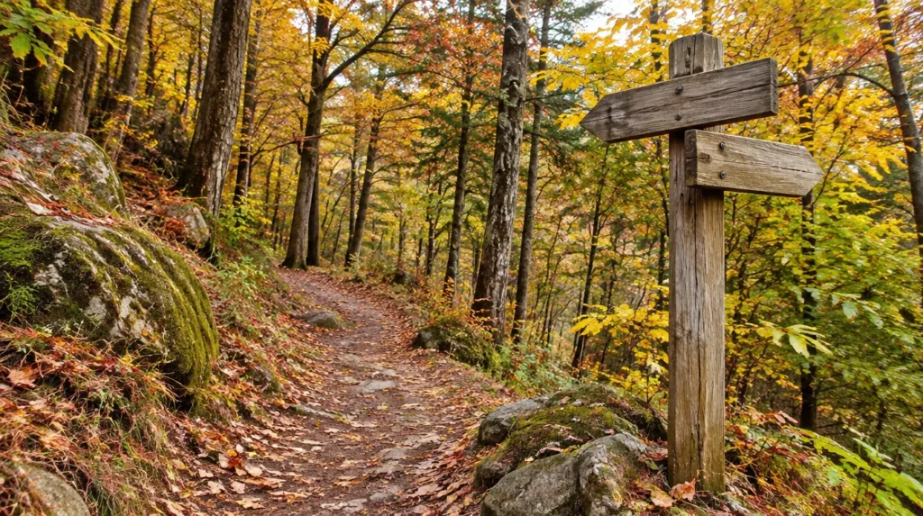
Ten minutes below the Hochwacht, the Vorderer Pfannenstiel is a farmstead with a bus stop and the Restaurant Pfannenstiel, a “Landgasthof” with a garden and Swiss home cooking: a different lunch dish every weekday, a Sunday roast, cakes and Znüni for hikers. Its old inn sign shows a pan of pitch, a nod to the Hochwacht signal fires.
This is the best start for the short walk to Meilen or the loop to the tower, and the best plan B if the weather turns: the 922 runs every hour, every day, down to Meilen station.
7. Eichhalden and Toggwil — the lake view
📍 Toggwil, 8706 Meilen (hamlet, about 40 minutes from Vorderer Pfannenstiel) · 🕐 always open · 🎟️ free · 🚌 Toggwil stop on bus 922 · ZVV walk description · 🗺️ Show on map
Leaving the forest, the path follows the edge of the wood at Eichhalden, where the whole of Lake Zürich opens up below you, with the Albis ridge and the Uetliberg opposite and the snowy Alps behind. It is the best view of the walk without climbing a tower. A short protected gorge, the Rappentobel, leads down to Toggwil, a small farming hamlet above Meilen.
Tired legs? Toggwil has a bus stop on the 922, so you can skip the last hour.
8. Meilemer Tobel — boulders and a waterfall
📍 Meilemer Tobel along the Dorfbach, 8706 Meilen (from Toggwil down to the village, about 45 minutes) · 🕐 always open; slippery after rain and frost · 🎟️ free · route description (German) · 🗺️ Show on map
The last section is the most varied: a steep wooded gorge with glacial boulders, wooden footbridges, steps and a large waterfall. It feels far wilder than you would expect five minutes above a lakeside suburb.
In winter the path can be icy, so wear boots with a good tread and take slip-on spikes after cold nights. If the gorge looks too slippery, the farm road from Toggwil via Burg to Meilen is the safe alternative.
9. Friedberg castle ruin — a castle from about 1200
📍 Burgruine Friedberg, 8706 Meilen (about 540 m, east edge of the gorge, 25 minutes up from Meilen station) · 🕐 always open · 🎟️ free · background (German) · 🗺️ Show on map
Just after the waterfall, on the left, are the walls of Friedberg castle, built around 1200 and first mentioned in 1306 as a castle of the lords of Regensberg. Only foundations and wall stubs remain, plus a dry moat cut into the sandstone and a 28-metre well cleared in the 1970s.
The digs of 1976 to 1979 found tiles, pottery, arrowheads and a curved wooden horn from the 14th century, one of the oldest wind instruments in Switzerland. The finds are shown in the Ortsmuseum in Meilen.
10. Meilen — the lake and the way home
📍 Kirchgasse 14, 8706 Meilen (Ortsmuseum; the station and the boat pier are 5 minutes away) · 🕐 Ortsmuseum Saturdays and Sundays 14:00–17:00, closed 21 December 2026 to 3 January 2027 · 🚆 S7 to Zürich HB in 14 minutes, at :03 and :33 · Ortsmuseum Meilen · 🗺️ Show on map
The gorge comes out in the old village of Meilen, a wine village on the right shore of the lake. The Ortsmuseum has a permanent room on Friedberg castle and another on the lake-dwelling settlements found on the shore; until 31 January 2027 it also shows a special exhibition on the painter Max Hunziker. Then walk down to the lake for a coffee at the water.
Going home by boat is the nicest finish, but the lake is unusually low this winter and the ZSG runs a reduced plan: the 1 h 45 cruise from Bürkliplatz stops in Meilen at 14:22 and is back in Zürich at 15:05. Check the ZSG timetable and our Lake Zürich boat trips guide. The car ferry Meilen–Horgen crosses all year if you want to continue to the other shore.
11. Küsnachter Tobel — the other way down
📍 Küsnachter Tobel, 8700 Küsnacht (from Forch via Wangen down to the lake, about 2 hours) · 🕐 always open · 🎟️ free · 🚆 S7 or S6 from Küsnacht to Zürich · Forchbahn walk tip (German) · 🗺️ Show on map
If you want a shorter, mostly downhill walk, leave Forch the other way, towards Kaltenstein and Wangen, and follow the stream down the Küsnachter Tobel, a protected gorge with about 70 wooden steps. Children love the “Drachenhöhle”, a cave where, so the legend goes, a dragon lived until the Virgin Mary chained it to the rock, then the Wulp castle ruin and the Alexanderstein, a huge glacial boulder.
The path ends at the Küsnachter Horn on the lake. It does not reach the Pfannenstiel tower, but it is a good second walk for another weekend.
A half-day route with times
This plan works for a Saturday in November or December, when it gets dark at about 16:45. In summer you can start later and stay for dinner on the terrace.
- 09:34 S3 from Zürich HB to Stadelhofen, then the S18 at 09:44; arrive in Forch at 10:05. After the timetable change on 13 December: S7 at 09:11 to Stadelhofen, Forch at 09:40.
- 10:15 Detour to the Forchdenkmal, then into the forest towards Guldenen.
- 11:30 Summit, then down to the tower: climb it while the light is good.
- 12:00 Lunch at the Hochwacht, or a sausage at the fire pit on the Okenshöhe.
- 13:30 On via Vorderer Pfannenstiel, Eichhalden and Toggwil.
- 14:30 Meilemer Tobel, waterfall and Friedberg castle.
- 15:15 Meilen; a coffee by the lake, then the S7 at 15:33 or 16:03, Zürich HB 14 minutes later.
Short version: S7 at 11:41 from Zürich HB, bus 922 at 12:01, lunch at Restaurant Pfannenstiel, the tower loop, then walk down to Meilen by about 15:30. Live departures are on our Zürich public transport live page, and the ticket rules are explained in getting around Zürich.
Food and picnics on the Pfannenstiel
- Restaurant Hochwacht, next to the tower: open every day, terrace, Swiss classics, fondue on the winter menu and game in autumn.
- Restaurant Pfannenstiel at Vorderer Pfannenstiel: home cooking, a weekday lunch menu at CHF 28 and a garden for summer.
- Fire pits: above the tower, on the Okenshöhe and at the covered rest area on the Eichhalden path, with tables and a fountain. Bring your own wood if it has been wet.
- Meilen: cafés and restaurants by the lake and around the station for the end of the walk.
There is no shop on the ridge, so buy water and picnic food in Stadelhofen before you board the Forchbahn. For more country restaurants with terraces, see our garden restaurants in Zürich and, for after the walk, the lakeside restaurants.
The Pfannenstiel in winter and at Christmas 2026
The Pfannenstiel is a lowland hike, so it works all winter with or without snow. Three things to know:
- Fog: in November and December the city often sits under a grey lid while the ridge is in the sun. The top of the fog layer often lies somewhere between 700 and 1,000 metres, so the tower at about 810 m is sometimes above it and sometimes just inside. Check the Hochwacht webcam before you go.
- Daylight and ice: it is dark before 17:00, so start by 10:00 for the full route. The gorge sections are the only tricky part after frost. The forecast is on our Zürich weather page.
- Snow: after a good snowfall the Guldenen trail is groomed for cross-country skiing, and the forest roads turn into easy winter walks. For sledging, see our sledging near Zürich guide.
Christmas 2026: the Hochwacht says it is open seven days a week, but it has not published special hours for 24–26 and 31 December yet, and the Restaurant Pfannenstiel was closed on Christmas Eve in past years. Phone before you plan a festive lunch. Trains run on the Sunday timetable on 25 and 26 December. What else is open is in our Christmas in Zürich guide.
The Pfannenstiel with kids
For families, take the bus to Vorderer Pfannenstiel and do the loop: the tower, a picnic and a fire on the Okenshöhe, and back to the bus within two hours. School-age children manage the short walk down to Meilen through the gorge, which is the exciting part. The Küsnachter Tobel with its dragon cave is the other family favourite. More ideas: things to do in Zürich with kids.
Prams: the forest roads between Forch, Guldenen and the Hochwacht are wide and mostly gravel, but the gorges have steps, so with a pram go back by bus from Vorderer Pfannenstiel.
Tips for the hike
- Zürich Card: it covers zone 110 and the neighbouring zones such as 140, but not Forch (130) or Meilen (141). Buy an extra ticket; see our Zürich Card guide.
- Follow the yellow signs for “Pfannenstiel” and “Hochwacht” from Forch, then “Meilen”. The paths are well signed; a map app is a bonus, not a must.
- Combine it with the Greifensee below the other side of the ridge on a long summer day, or compare it with the Uetliberg and the Felsenegg on the west side of the lake.
- By bike: the forest roads are open to bikes. Routes are in our cycling around Zürich guide.
Pfannenstiel: FAQ
How long is the Pfannenstiel hike from Forch to Meilen?
10.6 kilometres and about three hours of walking, with roughly 230 metres of climbing and 500 metres of descent. Add an hour for lunch at the Hochwacht.
Is the Pfannenstiel hike difficult?
No. It is rated easy and runs mostly on forest roads and good paths. Only the Meilemer Tobel has steps and can be slippery after rain or frost.
How do I get to the Pfannenstiel by public transport?
Take the S18 Forchbahn from Stadelhofen to Forch (21 minutes) for the full hike, or the S7 to Meilen and bus 922 to Vorderer Pfannenstiel (32 minutes from Zürich HB) to start near the top.
How high is the Pfannenstiel?
853 metres above sea level. The tower stands a little lower, at about 810 metres, and is about 30 metres high.
Is the Pfannenstiel tower free?
Yes, it is free and always open. Stay off it in ice, snow or strong wind.
Can you do the Pfannenstiel in winter?
Yes, it is open all year and one of the best fog-escape walks near Zürich. Start early, take spikes after frost, and check the webcam for the sea of fog.
Keep planning
- Winter hikes near Zürich: 12 walks by train
- Day trips from Zürich: 30 best trips by train
- Parks in Zürich: parks, gardens, hikes and lakes
- Türlersee, the lake below the Albis
- Rigiblick and Dolderbahn: the Zürichberg by funicular
- Zürichhorn park by the lake
- Rapperswil day trip
- Free things to do in Zürich
- Things to do in Zürich in winter
📬 The ZurichGuru newsletter
Once a week: the best events, new places and what is changing in Zürich. Free, unsubscribe any time.