'/%3E%3C/svg%3E) EN
 DE
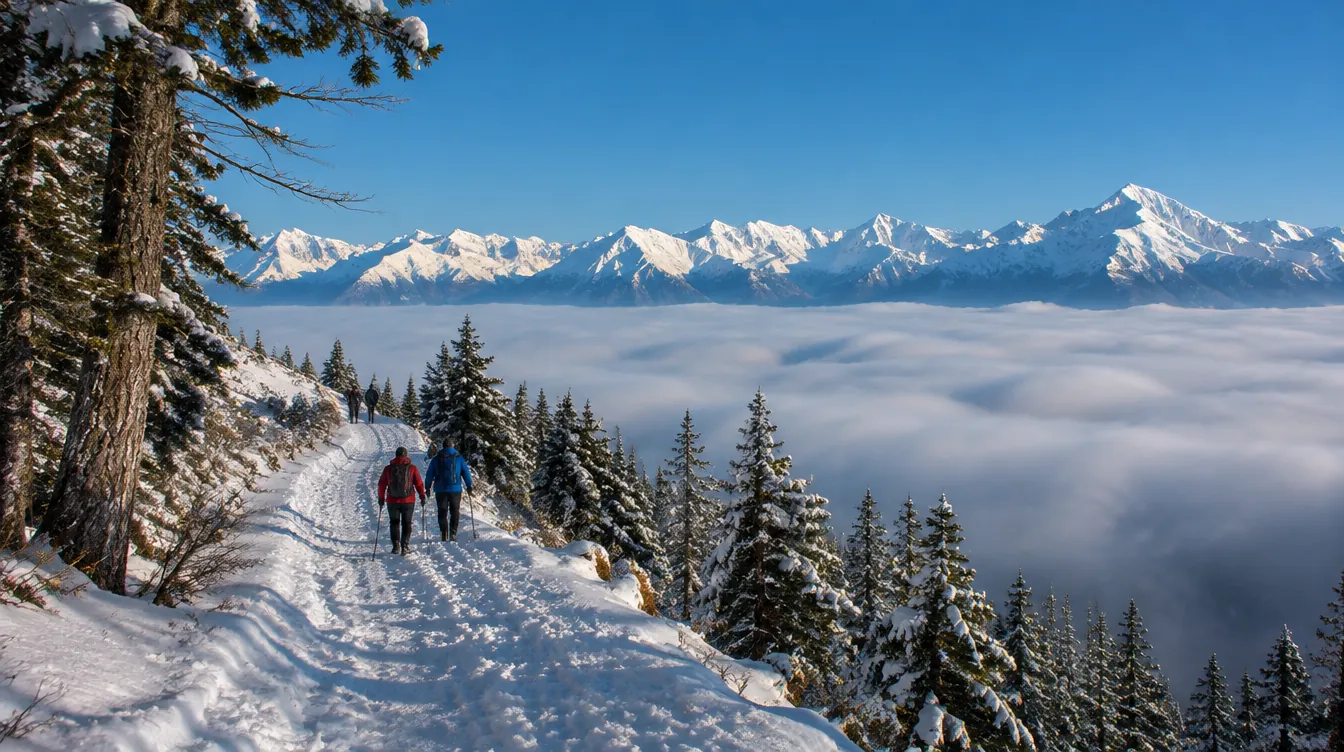
Winter hikes near Zürich are the best way to escape the grey: on many days the city sits under a lid of fog while the hills and Pre-Alps around it are in sunshine. You do not need a car or special gear, only good boots, because every walk below starts and ends at a train, bus or mountain railway stop. We picked twelve routes that work in winter, from forest walks 20 minutes from Zürich HB to groomed snow trails in the mountains. Distances, walking times and journey times were checked on the official sites in November 2026.
📍 12 walks from the Uetliberg (21 minutes) to the Rigi (about 1 h 50) · 🥾 2.8 to 18 km, 1 h 15 to 4 h · 🎟️ free on foot; you pay only for trains and lifts · 🚆 all by public transport from Zürich HB · SwitzerlandMobility winter hiking
Winter hikes near Zürich: snow or no snow?
The first five walks are lowland routes below 1,000 metres. They work all winter, with or without snow, and are perfect on fog days when the ridges poke out into the sun. Walks 6 to 12 are higher up, on groomed winter hiking trails that the mountain resorts prepare once there is snow. Those trails are marked with pink signs and only open when conditions allow, so check the operator’s page before you leave.
1. Uetliberg–Felsenegg — the Planet Trail above the fog
🥾 Uetliberg to Felsenegg · 📏 7.2 km, about 2 hours, 220 m height difference, easy · 🚆 S10 to Uetliberg, 21 minutes (from 13 Dec; until 12 Dec the S10 starts at Zürich Selnau) · ☕ Uto Kulm at the start, Restaurant Felsenegg at the end (winter: Mon–Thu 11:00–20:00, Fri–Sat until 22:00, Sun 10:00–20:00) · official route · 🗺️ Show on map
Zürich’s classic ridge walk is a scale model of the solar system: every metre stands for a million kilometres, from the Sun at the Uetliberg to Pluto at Felsenegg. The wide path is easy to follow in winter and has views over the city, the lake and, on clear days, the Alps. From Felsenegg, the cable car takes you down to Adliswil and the S4 back to town. Note: the Felsenegg cable car is out of service in March 2027 for maintenance.
The rest of the mountain, including the Uto Kulm “Winterzauber”, is in our Uetliberg guide, and the end point has its own Felsenegg guide.
2. Pfannenstiel — Forch to Meilen with a lookout tower
🥾 Forch station to Meilen · 📏 10.6 km, about 3 hours, easy · 🚆 S3 or S12 to Stadelhofen, then the S18 Forchbahn to Forch, about 31 minutes; back from Meilen with the S7 (14 minutes) or S6 · ☕ Restaurant Hochwacht on the Pfannenstiel, open daily 10:00–22:00, Sundays 9:00–20:00 · official route · 🗺️ Show on map
This walk follows the Pfannenstiel ridge on the “Gold Coast” side of the lake. From Forch it climbs gently through the woods, with views over the Greifensee to the Zürich Oberland. Just before the Restaurant Hochwacht stands a lookout tower of about 35 metres with a platform at 33 metres and a panorama over Lake Zürich to the Alps.
From Toggwil the path drops through the Meilen Tobel past boulders, a waterfall and the ruins of Friedberg castle. That gorge section can be slippery after frost, so take it slowly. Meilen station is right by the lake.
3. Greifensee — the flat loop around the lake
🥾 round the lake from Nänikon-Greifensee · 📏 about 18 km, about 4 hours, flat, easy · 🚆 S9 or S14 to Nänikon-Greifensee, 17–18 minutes · ☕ no stop we could confirm for winter; shorten the walk at Maur or Uster · official website · 🗺️ Show on map
The easiest long walk near Zürich: no climbs, reed beds, a little old town with a castle and plenty of water birds in winter. You can start and stop at Nänikon-Greifensee, Uster, Maur or Fällanden, all with public transport. Shorter options and the bird reserve are covered in our Greifensee guide.
4. Sihlwald forest trail — a short family walk in the wild forest
🥾 loop from Sihlwald station · 📏 2.8 km, about 2 hours with stops, 110 m up and down, medium · 🚆 S4 to Sihlwald, about 36–39 minutes (until 12 Dec the S4 starts at Zürich Selnau or Saalsporthalle) · ☕ no café in winter (the visitor centre is closed until 28 March 2027); fire pits with firewood by the visitor centre · official route · 🗺️ Show on map
The Walderlebnispfad in the Wildnispark Zürich has twelve stations in a forest that has been left to grow wild: counting tree rings, a boardwalk through a bog forest and natural sound games. The park says it suits children from four. Parts are steep, narrow and have steps, and the paths get slippery after snow or rain. Pack a thermos and sausages for the fire pits. More on the park in our Wildnispark Sihlwald guide.
5. Albis ridge — Albis pass to Albishorn and Tüfenbach
🥾 Albis Passhöhe to Tüfenbach · 📏 7.3 km, about 3 h 20, 280 m ascent, medium · 🚆 S2 to Thalwil, then bus 240 to Langnau a.A., Albispasshöhe, 39 minutes (hourly); back from Tüfenbach with bus 240 and the S2, about 45 minutes · ☕ the park lists the Restaurant Albishorn on the route; check its winter days before you go · official route · 🗺️ Show on map
The Wildnispark’s own winter route starts on the Albis pass and climbs to the Hochwacht lookout tower, with a first view over the Sihlwald forest to the mountains. It then drops into the wildest core zone of the forest, past the Waldmatt wetland and the Albishorn pond, before climbing to the Albishorn viewpoint and Bürglen, the highest point. The park says the walk is possible all year. The buses run once an hour, so check the times for the way back.
6. Zugerberg — high moors above Lake Zug
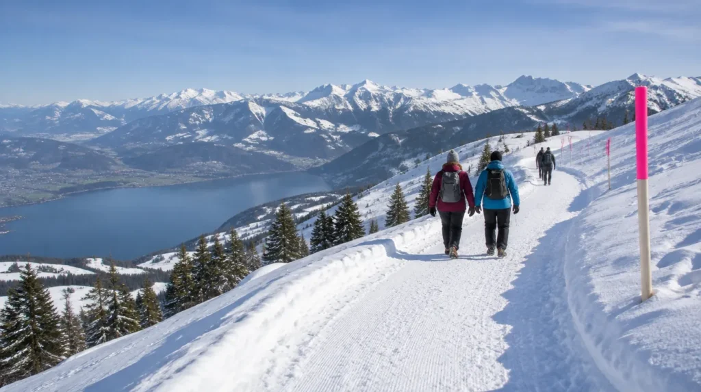
🥾 loop from the Zugerberg top station · 📏 10 km, about 3 hours, 240 m up and down, medium · 🚆 train to Zug and bus 603 to Schönegg, 40–45 minutes, then the funicular (CHF 6 one way, CHF 12 day ticket) · ☕ restaurants at Buschenchäppeli halfway and at the top station; check their winter days · official route (no. 440) · 🗺️ Show on map
The quickest “real” winter hike from Zürich. The funicular takes eight minutes from town into open country, and the loop crosses high moorland to the little Buschenchäppeli chapel, then returns through snowy woods past a large playground at Schattwäldli. The views over Zug, the lake and the Central Swiss mountains are excellent. Check the funicular’s status report before you go.
7. Lake Sihl, Einsiedeln — from the abbey to the lake
🥾 loop from Einsiedeln (Brüel, by the abbey) · 📏 8 km, about 2 h 40, 140 m up and down, medium · 🚆 RE or S13 to Einsiedeln, 44–50 minutes · ☕ cafés and restaurants in Einsiedeln village at the start and finish · official route (no. 555) · 🗺️ Show on map
This groomed trail starts on the snowy meadow behind Einsiedeln Abbey, Switzerland’s most important place of pilgrimage, and heads down to the shore of the Sihlsee, the country’s largest reservoir, with the Ybrig mountains on the far side. On the way back you pass the Galgenchappeli and cross-country skiers on the Schwedentritt trail. It needs snow on the ground to be groomed, so check the conditions first.
8. Engelstock circuit, Sattel-Hochstuckli — a revolving gondola and a big view
🥾 loop from Mostelberg top station via the Mostelegg · 📏 5 km, about 1 h 50, 220 m up and down, medium · 🚆 IC to Arth-Goldau and S31 to Sattel-Aegeri, about 1 hour, then the revolving gondola (return CHF 30, children 6–15 CHF 15) · ☕ the Mostelberg top station area · official route (no. 563) · 🗺️ Show on map
The gondola cabins turn slowly as they climb, which children love. From Mostelberg, the trail passes the family ski area, a megalithic stone gate and a snowy forest to the Mostelegg pass, with a wide view over the Schwyz basin and the two Mythen peaks. The gondola runs daily from 28 November 2026, 8:45–16:30 (closed for overhaul 2–27 November, except on fine weekends). Details on the timetable and prices page.
9. Rigi Panorama Trail — along the old railway line
🥾 Rigi Kaltbad to Rigi Scheidegg · 📏 7 km, about 2 h 20, 220 m ascent, medium · 🚆 about 1 h 50 to Rigi Kaltbad (via Arth-Goldau and the Rigi railway, or via Küssnacht, Weggis and the cable car); back from Rigi Scheidegg via Kräbel and Arth-Goldau, about 1 h 20 · ☕ Hotel Rigi Kaltbad at the start; Berggasthaus Rigi Scheidegg at the end (closed 2–20 Nov and 21–24 Dec 2026) · official route (no. 570) · 🗺️ Show on map
The trail follows the line of the Rigi Scheidegg railway (1874–1931): flat as far as Unterstetten, then a gentle climb to Rigi Scheidegg, over old bridges and through a tunnel, with the Alps and the Schwyz valley in front of you. Rigi Bahnen says the area has about 35 km of groomed winter hiking trails.
November 2026: the Weggis–Rigi Kaltbad cable car does not run on weekdays from 16 to 27 November, and Hotel Rigi Kaltbad closes 23–27 November. Check the Rigi operating info.
10. Hoch-Ybrig — to the Seeblisee and Fuederegg
🥾 3S-Bahn top station to Seeblisee and Restaurant Fuederegg, optionally on to Laucheren · ⏱️ 45 minutes, plus 30 minutes to Laucheren, easy · 🚆 train to Einsiedeln, then bus 556 to Hoch-Ybrig, Talstation Weglosen, about 1 h 25, then the 3S cable car · ☕ Restaurant Fuederegg and Restaurant Laucheren on the route · official website · 🗺️ Show on map
Hoch-Ybrig publishes walking times rather than distances for its winter paths. The varied walk from the top station runs along the little Seeblisee lake and through a short stretch of forest to the Restaurant Fuederegg, then on an idyllic winter path to Laucheren. Other options are the 45-minute walk to the Restaurant Stäfel and a one-hour loop between the Sternen and Hesisbol chairlifts. The walks depend on the ski area being open; the resort has not published its 2026/27 opening date, so check the snow report.
11. Flumserberg–Seebenalp — three mountain lakes above Lake Walen
🥾 Tannenboden to Seebenalp and back · 📏 8 km, about 2 h 45, 320 m up and down, medium · 🚆 IR35 to Unterterzen (about 1 hour), then the gondola to Tannenboden, about 1 h 20 in total · ☕ Berghotel Seebenalp at the turning point, open during the ski season · official route (no. 171) · 🗺️ Show on map
From Tannenbodenalp the trail climbs through the Winkelzahn valley, crosses the flank of the Stellikopf with a view of the Walensee and the Churfirsten, and ends at three fir-lined mountain lakes, where the Berghotel Seebenalp has stood for more than a century. You return the same way. Flumserberg has 35 km of winter hiking trails in total, including the flat Seeblick loop. The resort says all pistes, including winter hiking trails, are closed from 17:00 to 8:00 because snow groomers with winch cables are at work. See winter hiking on Flumserberg.
12. Stoos — the quiet Nühusweidli trail
🥾 loop from the Stoosbahn top station to the Klingenstock chairlift valley station · 📏 4 km, about 1 h 25, 150 m up and down, easy · 🚆 train to Schwyz and bus 501 to Schwyz, Stoosbahn, about 1 h 20, then the Stoosbahn funicular · ☕ back in the car-free village of Stoos · official route (no. 580) · 🗺️ Show on map
The ride up on the Stoosbahn, one of the world’s steepest funiculars, is half the fun. At the top, the skiers go one way and this trail goes the other, through quiet farmland with the Muota valley below and the Mythen beyond. A short detour leads to a platform with a view down to the funicular’s valley station. The trail is signposted in one direction only.
Ice, daylight and safety
- Daylight is short. In December the sun sets around 16:30 in Zürich. Start before 11:00 and plan to be back at the train before dark, especially on forest routes.
- Ice is the main risk on low routes. Shady forest paths, gorges like the Meilen Tobel and steps in the Sihlwald freeze after cold nights. Wear boots with a good tread and carry slip-on spikes; walking poles help too.
- Stay on marked trails. Groomed winter hiking trails have pink signs. Never walk on ski pistes or into closed areas, and respect wildlife rest zones.
- Check before you leave. Mountain trails open and close with the snow. Use the operator links above, the MeteoSwiss forecast and, in the mountains, the SLF avalanche bulletin.
- Pack warm. Layers, hat, gloves, a hot drink in a thermos and a charged phone.
Trains and tickets for winter hikes near Zürich
Walks 1 to 5 are inside the ZVV network, so a day pass for the right zones covers the whole trip. For walks 6 to 12 you need an SBB ticket plus the mountain railway or lift; with a half-fare card both are usually cheaper. Two timetable notes for this winter: the SZU platforms at Zürich HB stay closed until 12 December 2026, so the S10 (Uetliberg) and S4 (Sihlwald, Adliswil) start at Zürich Selnau until then, and the new timetable starts on 13 December 2026. Check times on the SBB timetable.
Winter hikes near Zürich: FAQ
What is the easiest winter hike near Zürich?
The Greifensee loop is completely flat, and the Planet Trail from the Uetliberg to Felsenegg is short and easy. In the mountains, the Stoos Nühusweidli trail is rated easy.
Do I need snowshoes or special equipment?
No. All twelve walks are on paths or groomed winter hiking trails. Good winter boots are enough; slip-on spikes help on icy forest paths.
Where can I walk above the fog near Zürich?
The Uetliberg, Felsenegg and the Albis ridge often rise above the winter fog. For a safer bet, go higher: the Zugerberg, Rigi or Flumserberg.
Without leaving the city, the gorge walk from Burgwies via the Elefantenbach to Witikon makes an easy two-hour winter loop.
For a mountain that runs all winter, the Hoher Kasten above Appenzell is covered in our Appenzell day trip guide.
All routes over the ridge, the tower, both restaurants and the bus 922 short cut are in our full Pfannenstiel hike guide.
For a short, flat walk on a foggy day, the loop around the Türlersee takes about an hour and is reached by bus in 45 minutes from Zürich HB.
For a gentle lakeside walk instead of snow, the flat path in car-free Quinten is reached by boat all winter; details in our Walensee day trip guide.
More winter days out
Snow on the ground? Combine a walk with sledging near Zürich, or see which resorts suit you in skiing near Zürich.
📬 The ZurichGuru newsletter
Once a week: the best events, new places and what is changing in Zürich. Free, unsubscribe any time.